The Benefits and Pitfalls of using AI for Imagery and Mapping
August 04, 2026

AI is everywhere. It is permeating every facet of modern life. It can vastly improve some processes and industries. But its tendency to hallucinate and generate false data makes it a tough sell to others. When it comes to satellite imagery and mapping, into which camp does AI fall?
To find out, we need to weigh the potential benefits and risks to geospatial applications.
Benefits
There are clear cost and time savings that come with AI. Humans simply can’t compete with the speed and efficiency of a machine. Also, once the costs of hardware, software, AI training, implementation, and raw data are covered, the processing costs of the automated task are reduced. AI can reduce processing costs by automating repetitive tasks and allowing teams to work more efficiently.
There are documented instances where the use of AI significantly reduced the time required to extract and map large numbers of features from imagery. Because of its speed, AI allows smaller teams to work at a previously unimaginable scale. These models can improve over time when they are retrained and validated using new data. Speed also delivers more timely results so that users can make faster decisions and see emerging trends more quickly.
AI also allows a user who has not had formal mapping training to create sophisticated outputs from the raw data with a plain-language prompt. This simplifies the process and reduces the number of people needed to obtain the desired mapping.
AI can pull from all types of input data to compile features and information into a single display. It can also be equipped to automatically classify sensitive data for compliance and regulation. Properly designed systems can also maintain records of data sources and processing steps to support security, compliance, and traceability. Humans can be distracted, tired, ill, or busy. AI, on the other hand, can apply repetitive checks consistently and help identify errors and inconsistencies attributed to manual processing by using standard processes and formats. It is excellent at detecting missing field values, duplicate features, and incorrect data types in certain attribute fields.
AI clearly offers amazing benefits to mapping projects. However, AI is just code and hardware. Today’s geospatial AI has drawbacks that have not yet been overcome.
Risks
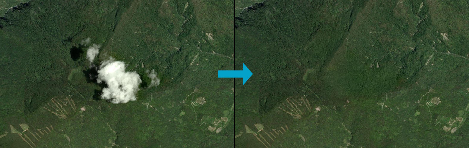
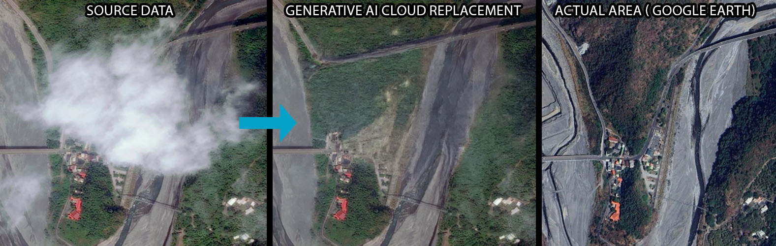
In mapping, AI has been known to create what are called “hallucinations.” It has been known to create incorrect spatial features such as roads that aren’t there, represent vegetation-heavy swamp as solid ground, or classify building types incorrectly. These problems are often the result of AI trained on incomplete, outdated, or unrepresentative input data, initial human bias, or errors in the prompts. Mistakes like these can be amplified over time and increasingly misrepresent the area.
As mapping AI transitions from training to everyday, practical use, the accuracy of the output can decay as time passes if the underlying data (satellite and aerial imagery, road networks, or sensor data) changes. This produces outdated and inaccurate mapping results that steadily worsen.
These mapping errors can cause users to make wrong decisions.
- An incorrect slope could lead to dangerous road construction, putting drivers at risk and costing time and money to correct.
- Misidentified boundaries can lead to illegal construction on an unauthorized site.
- Incorrect crop identification can lead to improper agricultural assessment and prescription, leading in turn to weaker yields or crop failure.
- Missing a small valley due to high tree canopy can lead to failure to plan for disaster mitigation for a downstream community that is unknowingly in danger of potential flooding.
AI mapping errors can be especially consequential in sensitive areas such as secure facilities or industrial sites. In addition, public or unvetted AI tools may release confidential information or private data inadvertently. Unless appropriate controls are in place, AI tools may process or expose sensitive data and may use inputs without confirming that the necessary permissions or licenses exist. Intellectual property infringement is a significant legal risk.
Because AI cannot accept responsibility for its outputs, accountability remains with the organizations and professionals that deploy and rely on it. Human oversight is, therefore, essential when AI-generated mapping may affect safety, cost, confidentiality, or operational decisions.
Strategies to safely use AI in mapping
The best way to reap the benefits of AI without absorbing the risks is always to use it with a human in the loop. In this arrangement, trained professionals assess the AI input and output on an ongoing basis to validate the results. Trusting AI alone to map the world accurately is unwise and could be dangerous.
To avoid legal risks, keep thorough records of the data used to train and enhance AI processes. Synthetic data can help reduce privacy and data-availability concerns, but it should be carefully validated against representative real-world data before the model is placed into operational use.
If your group has properly licensed and representative proprietary data to train the AI system, it may improve the relevance and control of the results. However, the data must still be reviewed for quality, privacy, licensing, and suitability for the intended use.
Using AI is becoming a competitive necessity. Considering how heavy the data used in mapping is, there are clear benefits to utilizing AI to lighten that load. If a group proceeds intelligently, consistently, and cautiously, AI can and will make mapping easier and faster. But never lose sight of what trusting AI too much could cost.